We explain what the continents are and what their main characteristics are. Also, the origin of their names and land limits.
What is a Continent?
A continent is a large expanse of landmass, separated from others, either by oceans or by another significant geographical feature.
With the exception of Antarctica (which maintains a constantly cold climate ), each continent presents in its territory a wide variety of geographical features, climates, languages, and cultures.
There are several continental models:
- 4 continents. Euphrasia (Europe, Africa, and Asia), America, Oceania, and Antarctica.
- 6 geological continents. Eurasia (Asia and Europe), North America, South America, Oceania, Antarctica, Africa.
- 6 continents. Antarctica, America, Antarctica, Africa, Europe, and Oceania. This is the traditional model and the one used in this text.
Geological formation
Geological investigations have determined that the continents that are currently separated were once united in a single landmass, surrounded by seas. This most recent "single continent" existed 180 million years ago, it is called Pangea and from it come to the current continents.The Pangea was divided due to a phenomenon called Continental Drift, discovered in 1912 by Alfred Wegener. Continental Drift occurs because the planet is covered by a crust formed by plates that float on a viscous fluid. That fluid, called magma, we can observe in volcanic eruptions.
Since the plates are floating, they move, albeit very slowly. This movement caused the continents that made up the Pangea to separate. But in addition, the collision of various plates has caused the formation of mountain ranges and other geographical features.
Africa
 It is almost completely surrounded by seas since it is located between the Atlantic Ocean (which limits it to the West) the Indian Ocean (which limits it to the East) and the Mediterranean Sea (which limits it to the North and separates it from Europe). It is separated from Asia by the Red Sea but joined to it by the Isthmus of Suez.
The total area of Africa is 30,272,922 km2 and its population is over one billion people. In its territory, there are 54 countries. Although large areas of plains are found in its relief, there are also mountain ranges such as the Atlases and the Drakensberg mountains.
America
 This continent is completely surrounded by water: the Arctic Ocean to the north, the Pacific Ocean to the West, the Atlantic Ocean to the East, and the confluence of the Atlantic and Pacific to the south.
Its relief, along the entire continent, presents a mountain range to the west, called the Rocky Mountains in North America and the Andes Mountains in South America.
Its surface area of 43,316,000 km2 is divided into three subcontinents:
- South America. With an area of 18,005,000 km2, it is home to more than 416 million inhabitants, distributed in 12 countries. Here is Aconcagua, the highest peak in America.
- Central America. It is the region with the smallest surface area in America, with 522,760 km2, and approximately 47 million inhabitants. In it, there are 8 independent countries, some of the islands. It is an area of great volcanic activity. Due to its location, it is characterized by a warm and humid climate.
- North America. With a huge area of 24,323,000 km2, it contains only three countries: Canada, Mexico and the United States. Its population is over 570 million inhabitants.
Antarctica

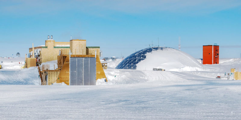
Antarctica is the only continent that does not have a permanent population, and only has temporary inhabitants whose number varies between 1,000 and 5,000. Most of them belong to scientific expeditions. It has a total area of 14 million km2, which is claimed by various countries.
Asia
 It is the continent with the largest area: 44,541,138 km2. It is also the continent with the largest population, approximately 4,400,000,000 inhabitants. On this tectonic plate, earthquakes and volcanic activity are frequent.
In its relief, there are mainly plateaus and plains, but also mountain systems to the center and west, such as the Himalayan mountain range.
Europe
 Europe is in the Northern Hemisphere. Of the continents, it is the second smallest, with an area of 10,530,751 square kilometers. Its population is almost 750 million inhabitants, with a density of 70 inhabitants per square kilometer. In Europe, there are 50 countries.
In its relief, Mount Elbrús stands out, with a height of 5,633 meters above sea level, in the Caucasus region. Its rivers are divided into four slopes: Arctic, Atlantic, Mediterranean, and the slope that flows into the Caspian and Black Seas, towards the East.
Oceania
 It is the smallest continent, with an area of 9,008,458 km2 and a population of approximately 40 million inhabitants. It is made up of a central continental shelf (Australia) and the islands of New Guinea, New Zealand, Micronesia, Melanesia, and Polynesia.
Australia represents 89% of the continent. Its relief is a great plateau, a group of plains, and the Great Dividing Range. The islands that make up the continent are mountainous and volcanic and famous for their paradisiacal landscapes.
Origin of names
- Africa. There is a debate about this name. Some historians maintain that it was named this way by the Romans, who found the Afri people there, and therefore "Africus" would be the land of Afri. But it can also mean in Greek "where the sea foams."
- Antarctica. It comes from the Greek word antarktike, which means "the opposite of north."
- America. In honor of Américo Vespucio, who made the first maps of this territory and discovered that it was a continent.
- Asia. It is believed that it was used by Herodotus for the first time to refer to the Persian empire and that it was later generalized throughout the continent.
- Europe. It could have been named in honor of the Greek goddess or it could come from the Greek word that refers to the West since for the Greeks this was the westernmost continent.
- Oceania. In reference to the Greek nymphs "daughters of the ocean."
Land boundaries

Some continents, such as America, Antarctica, and Oceania, have clear boundaries as they are surrounded by oceans. Although on a map the division between Europe and Asia seems more arbitrary, in reality, it also responds to a geographical accident: the Ural Mountains.
The other land limits have been determined in isthmus: a narrow strip of land between seas. For example, the Isthmus of Suez divides Africa from Asia.
The islands
Although many of the islands do not belong geologically to any continent, geographically they are considered part of the continent to which they are closest. For example, although the Canary Islands are part of Spain, they belong geographically to Africa.
The above content published at Collaborative Research Group is for informational and educational purposes only and has been developed by referring to reliable sources and recommendations from technology experts. We do not have any contact with official entities nor do we intend to replace the information that they emit.
Passionate about understanding and contributing to a world that does not stop changing. New forms of Work, Sustainability and Technology. For many years he has worked as a creative for large international companies. He has a Ph.D. in information technology and he has been doing quantitative research in the interdisciplinary areas of information systems, cyber security, data analytics and artificial intelligence. He continue to look for creative solutions through technology to help companies to be more humane and sustainable..
Leave a reply
Your email address will not be published. Required fields are marked *Recent post

Sport: What Is It, Types, Risks, Features, Characteristics and Examples

Dogs: Emergence, Features, Characteristics, Feeding and Breeds

Story: Definition, Elements, Structure, Features and Characteristics

